

Audubon, Barrington, Haddonfield, and Haddon Heights are partnering on a planning study to map the flow of stormwater in their communities as a first step to remediation efforts.
By Matt Skoufalos | January 17, 2022

Four photos show the impact of storm damage on a borough stormwater system on Concord Drive. The lower right photo was taken after the cleanup; the other three were taken the day after the storm. Credit: NJPEN.
Four Camden County towns are pooling their resources to tackle the underlying causes of pooling water on their roadways.
The municipal governments of Audubon, Barrington, Haddonfield, and Haddon Heights are collaborating on a project that seeks to identify the flow of stormwater across their borders, with the eventual aim of developing mitigation strategies to curb shared flooding issues.
The two-phase project includes a study of the current drainage infrastructure in all four communities, plus options for green infrastructure that could ameliorate areas of shared concern.
Its anticipated completion date is August 2022.
The project is funded by a $167,000 Transportation Community Development Initiative (TCDI) grant from the Delaware Valley Regional Planning Commission (DVRPC), with each participating municipality contributing a 20-percent funds match.
The communities contracted with Pennoni Associates of Haddon Heights to handle the technical aspects of the project, including Geographic Information System (GIS) mapping of the area, said Ken Shine, Project Manager at Pennoni, in a briefing on the project last week.
Matt Quackenbush, GIS Technical Manager at Pennoni, said the software system can overlay additional data onto those maps, including bus stops and routes, details on pipe sizes, information from the Federal Emergency Management Agency (FEMA), and locations of historical areas of concern as far back as 1930.
Next up is determining the accuracies of these maps through field verification, and logging any additional issues not yet catalogued through prior efforts.
“Haddonfield has a good well map,” Shine said; “the other three boroughs are playing catch-up.”
At the conclusion of the work, each borough will be given the license for its own GIS map data, which will allow for the maps to be updated individually in the future.
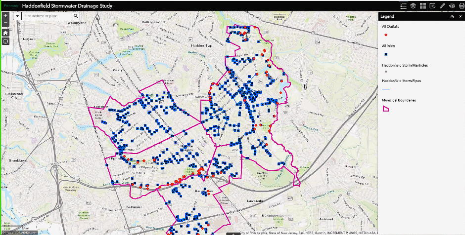
Haddonfield Stormwater Drainage GIS Map. Credit: Pennoni Associates.
“We’ll be doing our analyses to look at what needs to be done to help an entire area,” Shine said. “[The maps] will include specific insights—drainage pits, seepage pits, model ordinances—to see what kinds of improvements might lead to something down the line.
“Projects can always be phased and prioritized, making improvements in a staged fashion to accommodate budget,” he said.
The GIS maps indicate “problem areas,” in which stormwater drainage seems poor, in red, Shine said. Solutions could include installing inlets to help mitigate flooding in those areas, converting heavily paved areas to green space, or installing underground pipes to help water percolate down into the soil and away from the roadway.
But underground stormwater storage—like the buried cisterns popular with developers seeking relief from pervious coverage statutes in Haddonfield—”might not work if the water table’s high,” Shine said. Mapping in the wake of prior storms has previously identified a number of underground streams near ground level.
Haddonfield Borough Administrator Sharon McCullough said that surging rainfall in the borough can displace some 400 acres of water during a storm, and “pipes in the ground only do so much.
“Our philosophy has been to get the water underground and off the roadway so it’s a little safer, but with the density we have, we have to come up with more than just pipes,” McCullough said. “That’s why we’re focusing on the green infrastructure portion of this.”
Audubon Sewer. Credit: Matt Skoufalos.
Neither are the kinds of solutions that can work in less dense communities optimal for Haddonfield.
McCullough acknowledged that the municipal government isn’t likely to demolish any of its high-value homes to give land over for groundwater recharging.
Neither is the large-scale housing redevelopment project planned for the former Bancroft site likely to improve conditions in areas already susceptible to flooding.
The borough planning board is considering amending its pervious coverage limits; however, if it tightened up those measures, “most of the properties in town will be non-conforming,” McCullough said.
“The key part of green infrastructure is you have to stop it at its location before it goes to flooding,” she said.
“Does it make sense for parking lots to be pervious pavement?” McCullough said. “Does it make sense for road programs of the future to have pervious sidewalks with drainage underneath? Does it make sense to have more rain gardens?”
Downstream effects
Even before arriving at the solutions stage of the study, another key critique of the project is whether the effort is expansive enough to address stormwater outflow issues in the communities adjacent to those participating.
Lorraine Prince, President of the citizen environmental group Newton Creek Watershed Association, said that without mapping data from communities downstream of those involved in the project—like Collingswood, Haddon Township, and Oaklyn—any solutions implemented could aggravate flooding issues there.
“I think the [Haddonfield] businesses and the commuters will appreciate the effort, but the study is sort of short-sighted because it isn’t looking at the other towns that are in the watershed,” Prince said.
“Not having any downstream data is going to make what you do less efficacious,” she said. “These three towns are not an island.”
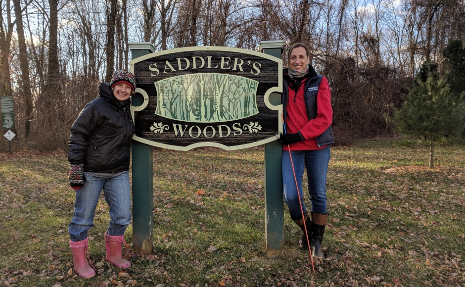
Newton Creek Watershed Association members Lorraine Prince (right) and Janet Goehner-Jacobs in Saddler’s Woods, 2018. Credit: Matt Skoufalos.
Prince, who has followed along closely with the multi-phase Newton Creek dredging project—especially its connection to the Saddler’s Woods conservation area in Haddon Township—worried that a higher volume of stormwater outflow into the watershed could undercut the work of the dredge.
“Just because Newton Lake is going to be maybe two feet deeper than it was, that’s not going to help if Haddonfield is dumping more water into a system that feeds into it,” Prince said.
Prince was equally curious as to what green infrastructure mechanisms the boroughs might employ to alleviate flooding, especially given the degree to which the towns are already built out. The most effective green infrastructure solutions—de-paving and creating open spaces to absorb stormwater runoff—are unlikely to be employed in these densely developed communities.
“Underground piping may hold it over until the water percolates down, but the water table’s high,” Prince said. “All I can picture at this time is that they’re going to send the water into street drains with existing sewer pipes.”
McCullough countered that “the intent of the report is to cut back on what’s being put into the waterways,” and that its work could help to inform “an overall plan for the county that shows the interaction” among the stormwater systems of Audubon, Barrington, Haddonfield, and Haddon Heights.
“Trying to make the municipalities and the county act as a regional entity is why we started this grant,” McCullough said. “Most of the towns surrounding us are built out, or significantly built out, and never had any infrastructure in the first place.
“If we can start with our project and convince the other towns to help deal with it, we can start talking about the things that impact each town,” she said.
“If there is a project that is going to be able to benefit more than one municipality, we’ll be looking to see what other grant funds are out there.”
Audubon Mayor Rob Jakubowski said that the likely biggest takeaway from the project for his community will be mapping flood-prone areas in order to secure funding to remedy environmental issues in the future.
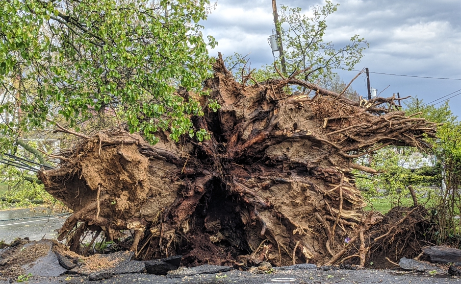
Upended tree root system after a storm in Haddon Heights. Credit: Matt Skoufalos.
“There’s certain areas in town that historically have flood problems—not a little extra water, but where the street becomes impassable,” Jakubowski said.
“It’s going to give us that map immediately, so that if we want to go for funds down the road, by ourselves, or with that same collective group, we actually have details.”
Many Camden County communities have faced increased storm-driven flooding and environmental damage from extreme weather in the past few years, and Audubon is no exception, the mayor said.
Identifying the points to be shored up is the first step towards preventing more widespread problems; the borough will also be applying for a grant from the New Jersey Board of Public Utilities to create a municipal environmental strategic plan.
Jakubowski hopes that Pennoni’s recommendations also will include specific strategies and solutions for addressing those issues, including new sidewalk composites, underground pipe systems, or limiting impervious surface coverage at planning board applications.
“We know there are areas where we need to fix different types of pipes that go out,” Jakubowski said. “We may have to be tougher if someone wants to put in a driveway.
“I look forward to seeing what Ken Shine has for us,” he said.
Please support NJ Pen with a subscription. Get e-mails, follow us on Facebook, Twitter, and Instagram, or try our Direct Dispatch text alerts.


